「汐止大尖山」【台灣小百岳】(編號:12號)和「秀峰瀑布」常常爬,「四分尾山」跟「茄苳古道」已經許久沒有走!今天走起來就感覺差異很大?
尤其是「四分尾山」步道,以前需要拉繩而上的路段,都改成寬廣的步道,不用再拉繩了!
「茄苳古道」因為較少人走,仍能維持自然步道樣貌!
[行程]
由汐止火車站出發,走秀峰路轉勤進路,經靜修禪院、慈航紀念堂、天秀宮、秀峰瀑布、大尖山、四分尾山、茄苳古道、茄苳瀑布,回到汐止火車站。

汐止大尖山與綜合運動場

靜修禪院

慈航紀念堂

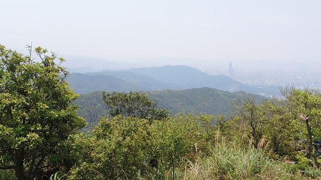
天秀宮前勤進路望台北市區

秀峰瀑布入口指標與導覽圖

沒水的秀峰瀑布

往大尖山步道

大尖山頂∼海拔460公尺,圖根點 (
【台灣小百岳】:編號12號)

大尖山頂遠眺基隆山

大尖山頂遠眺基隆嶼

大尖山解說牌

四分尾山步道∼"五四縱走"指標
『五四縱走』是指從五分山經頂子寮山、望古山、中窯尖、姜子寮山至磐石嶺後,
再轉上稜走耳空龜山到汐止的四分尾山和大尖山,
全程長達二十多公里、約需十小時以上;
其中「五分山」與「四分尾山」各有兩個三角點,
故以此兩山字首為名,稱為『五四縱走』。
《縱走路線中:五分山、姜子寮山、汐止大尖山為【台灣小百岳】。》

四分尾山步道

四分尾山步道

四分尾山步道與茄苳古道岔路

四分尾山∼海拔641公尺,又稱"茄苳腳山";
三等三角點八三七號(照片中圓心內)與二等三角點1060號(照片右下角)
※ 以前∼我對於三等三角點在圓心,二等三角點在一旁,一直無法理解!後來,瞭解三等三角點是【地籍三角點】,二等三角點是【陸測三角點】之後,我才體會其中的意義。 (◎ 瞭解【地籍三角點】、【陸測三角點】的差別,請按這裡!)

四分尾山解說牌

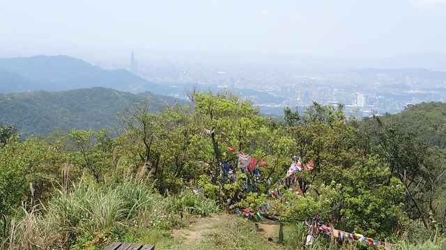
四分尾山眺望基隆方向
[短片段]∼四分尾山360度視野
[短片段]∼四分尾山

茄苳古道與土地公廟
看到這個土地公廟,就讓我想起也是發生在汐止四分尾山區的一段
〔山中奇遇!〕

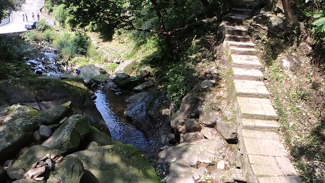
茄苳溪溪谷

茄苳古道

茄苳古道崩塌段∼翻越崩塌區域而過

穿越崩塌區回到茄苳古道

茄苳溪溪谷

茄苳溪溪谷

茄苳瀑布

茄苳瀑布
[短片段]∼茄苳瀑布

茄苳瀑布入口的各式標誌

全程軌跡圖(紫色為行進軌跡)
(紅色虛線為步道)
App: 歐樂斯地圖(Oruxmaps)
離線地圖: 台灣登山地圖(魯地圖Taiwan TOPO)

行程數據(僅供參考!)
時間:5小時23分
步程:11.87公里
[網路相簿]看更多照片請按這裡
《相關〔網誌〕連結》
↓ 請點以下連結,進入〔網誌〕參閱!↓
◎ 【台灣小百岳】
◎ 《台北天際線》
◎ 『三角點』∼淺釋
◎ 日治時期的【地籍三角點】與【陸測三角點】


